
Environment Canada has issued a long list of weather warnings and watches across the country. South of the border, the US faces the same devastating conditions as homes and businesses lose power and travellers are frustrated by treacherous roads and thousands of thousands of flight cancellations.
In the Atlantic region a large, slow-moving storm is expected to unleash an ugly mix of heavy snow, rain, freezing rain and ice pellets starting Thursday night and extending into the weekend.
Nova Scotia can expect an extended period of freezing rain, New Brunswick is bracing for up to 50 centimetres of snow across the southern half of the province and PEI could also see up to 50 centimetres on the eastern side of the Island.
Rainfall warnings have been issued for parts of eastern Newfoundland, but freezing rain and ice pellets are also part of the mix — and a winter storm watch has been issued for central Newfoundland, where up to 50 centimetres of snow could accumulate by Saturday night.
A winter storm warnings for places in Ontario including Hamilton and Niagara, where up to 30 centimetres of snow is expected Thursday night.
It has also issued snowfall warnings in some areas, such as London and Sarnia, where up to 20 centimetres of snow is expected Thursday evening.
In parts of northern Ontario, the weather agency has issued extreme cold warnings, noting a period of very cold wind chills is expected to continue.
There are also numerous warnings for various parts of Quebec, the central and western provinces, which include winter storms, blizzard conditions and extreme cold.
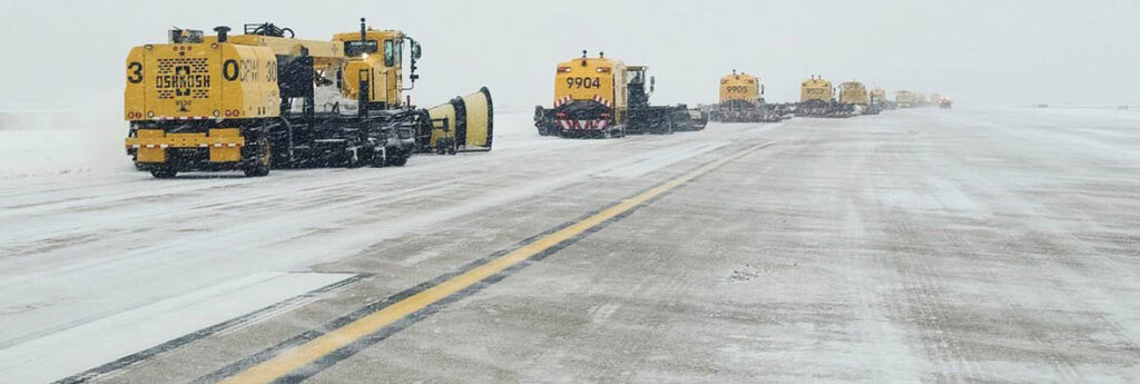
Check your area HERE – and expect flight delays and cancellations.
The United States
More than 200,000 homes and businesses lost power across the US on Thursday as power companies struggled to keep pace with freezing rain and snow that weighed down tree limbs and encrusted power lines, part of a multiday winter storm that dumped more than a foot of snow in parts of the Midwest and triggered weather warnings from Texas to the Northeast.
Storm conditions caused headaches for travellers across the country as airlines cancelled more than 6,000 flights scheduled for Thursday or Friday in the US At Dallas-Fort Worth Airport, authorities shut down all runways Thursday morning and reported more than 1,000 cancelled flights. On Wednesday as the storm began, there were more than 2,000 cancellations.
The highest totals of power outages blamed on icy or downed power lines were concentrated in Tennessee, Arkansas, Texas and Ohio, but the path of the storm stretched further from the central US into the South and Northeast on Thursday.
Heavy snow was expected from the southern Rockies to northern New England, while forecasters said heavy ice buildup was likely from Texas to Pennsylvania.
Parts of Ohio, New York and northern New England were expected to see heavy snowfall as the storm moves to the east with 12 to 18 inches (30 to 45 centimeters) of snow possible in some places through Friday, Orrison said.
Along the warmer side of the storm, strong thunderstorms capable of damaging wind gusts and tornadoes were possible Thursday in parts of Mississippi and Alabama, the Storm Prediction Center said.
In western Alabama, several homes were damaged and people were injured and trapped following an apparent tornado in rural Hale County, Emergency Management Director Russell Weeden told WBMA-TV. The National Weather Service issued several tornado warnings in the region as a line of storms moved through.
More than 20 inches (51 centimeters) of snow was reported in the southern Rockies, while more than a foot of snow fell in areas of Illinois, Indiana and Michigan.
Sleet and freezing rain were occurring early Thursday in the Dallas-Fort Worth area and in parts of Oklahoma and Arkansas. More than 200,000 homes and businesses were without power, mostly in Texas, Tennessee and Arkansas, according to the website poweroutage.us, which tracks utility reports.
Tennessee had the highest number of reported power outages by midday, particularly in Memphis and surrounding areas in West Tennessee.
Trees sagged under the weight of ice in Memphis, resulting in fallen tree limbs and branches. Parked cars had a layer of ice on them and authorities in several communities around the city warned of some cars sliding off slick roadways.
In Texas, the return of subfreezing weather brought heightened anxiety nearly a year after February 2021’s catastrophic freeze that buckled the state’s power grid for days, leading to hundreds of deaths in one of the worst blackouts in US history.
The frigid temperatures settled into areas after the snowy weather, with Kansas residents awakening to dangerous wind chills of around 15 below zero (26 degrees Celsius below zero). In New Mexico, schools and nonessential government services were closed in some areas Thursday because of the icy roads.
The disruptive storm began Tuesday and moved across the central US on Wednesday’s Groundhog Day, the same day the famed groundhog Punxsutawney Phil predicted six more weeks of winter. The storm came on the heels of a nor’easter last weekend that brought blizzard conditions to many parts of the East Coast.