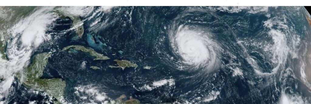
An extremely active upcoming Atlantic hurricane season has been predicted by researchers at Colorado State University in their initial 2024 outlook. Pointing to record warm tropical and eastern subtropical Atlantic sea surface temperatures as a primary factor, the CSU Tropical Weather and Climate team is forecasting 11 hurricanes this year – the highest prediction for hurricanes ever issued in the institution’s April outlook.
Moreover, the team predicts 23 named storms during the Atlantic hurricane season, which runs from June 1 to Nov. 30. Of those, the researchers forecast 11 to become hurricanes and five to reach major hurricane strength (Category 3-4-5) with sustained winds of 179 kph or greater.
The prior April forecast high was for nine hurricanes, which has been called for several times since the university began issuing the forecasts in 1995. However, the team stresses that the April outlook historically has the lowest level of skill of CSU’s operational seasonal hurricane forecasts, given the considerable changes that can occur in the atmosphere-ocean between April and the peak of the Atlantic hurricane season from August–October.
The researchers explain that when waters in the eastern and central tropical and subtropical Atlantic are much warmer than normal in the spring, it tends to force a weaker subtropical high and associated weaker winds blowing across the tropical Atlantic, likely leading to a continuation of well above-average water temperatures in the tropical Atlantic for the peak of the 2024 Atlantic hurricane season.
A very warm Atlantic favours an above-average season since a hurricane’s fuel source is warm ocean water. In addition, a warm Atlantic leads to lower atmospheric pressure and a more unstable atmosphere. Both conditions favour hurricanes.
While the tropical Pacific is currently characterized by El Niño conditions, these are likely to transition to La Niña conditions by the peak of the Atlantic hurricane season from August to October, add the researchers. La Niña tends to decrease upper-level westerly winds across the Caribbean into the tropical Atlantic. These decreased upper-level winds result in reduced vertical wind shear, favouring Atlantic hurricane formation and intensification.
So far, the 2024 hurricane season is exhibiting characteristics similar to 1878, 1926, 1998, 2010 and 2020.
Our analog seasons were all very active Atlantic hurricane seasons,” said Phil Klotzbach, senior research scientist in the Department of Atmospheric Science at CSU and lead author of the report. “This highlights the somewhat lower levels of uncertainty that exist with this outlook relative to our typical early April outlook.”
The team predicts that 2024 hurricane activity will be about 170% of the average season from 1991–2020. By comparison, 2023’s hurricane activity was about 120% of the average season.
The most significant hurricane of the 2023 Atlantic hurricane season was Hurricane Idalia, which made landfall at Category 3 intensity in the Big Bend region of Florida, causing $3.6 billion dollars in damage and resulting in eight direct fatalities.
The report also includes the probability of major hurricanes making landfall:
- 62% for the entire US coastline (average from 1880–2020 is 43%).
- 34% for the US East Coast, including the Florida peninsula (average from 1880–2020 is 21%).
- 42% for the Gulf Coast from the Florida panhandle westward to Brownsville (average from 1880–2020 is 27%).
- 66% for the Caribbean (average from 1880–2020 is 47%).
Further forecast updates will be issued on June 11, July 9, and Aug. 6.

