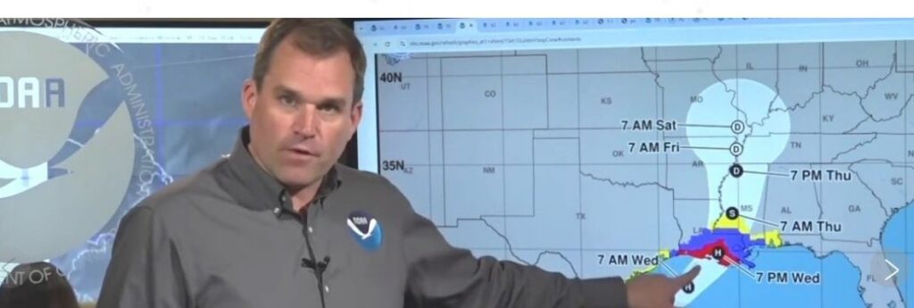
Louisiana is bracing for Francine today (Wednesday), a storm that was expected to achieve hurricane status overnight before barreling into a coastline that has yet to fully recover since hurricanes Laura and Delta decimated Lake Charles in 2020, followed a year later by Hurricane Ida.
The sixth named storm of the season threatens the possibility of life-threatening winds and storm surge, promoting a hurricane warning along the Louisiana coast from the border with Texas eastward to Grand Isle, about 80 km south of New Orleans, and a tropical storm warning eastward from there to the mouth of the Pearl River, according to the US National Hurricane Center.
A storm surge warning stretched from just east of Houston to the mouth of the Mississippi River south of New Orleans.
There’s also the potential for 10 to 20 cm. of rain with the possibility of 30 cm. locally across much of Louisiana and Mississippi through Friday morning, which could also cause considerable flash and urban flooding.
Louisiana Gov. Jeff Landry urged residents “not to panic, but be prepared” and heed evacuation warnings. Forecasters said Francine’s landfall in south Louisiana was expected Wednesday afternoon as a Category 2 hurricane with winds of 155 to 175 kph.
Francine is barreling toward a 22-storey building in Lake Charles that had become a symbol of storm destruction, which was imploded last week after nearly four years, its windows shattered and covered in shredded tarps.
Residents of Baton Rouge, Louisiana’s capital, began forming long lines as people filled gas tanks and stocked up on groceries. Others filled sandbags at city-operated locations to protect homes from possible flooding.
In New Orleans, Mayor LaToya Cantrell urged residents to prepare to shelter in place. City officials said they were expecting up to 15 cm inches of rain, gusty winds and “isolated tornado activity” with the most intense weather likely to reach New Orleans on Wednesday and Thursday.


