

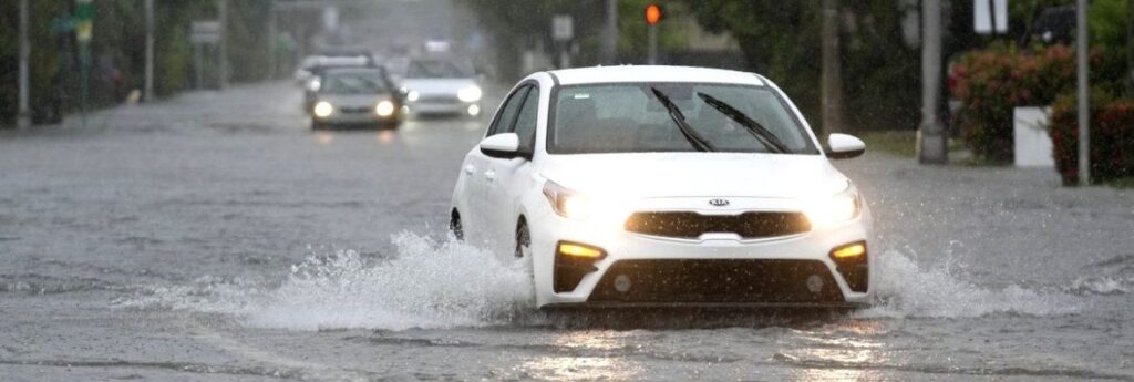
The annual rainy season has arrived with a deluge in much of Florida, where a disorganized disturbance of tropical weather from the Gulf of Mexico has caused street flooding and triggered tornado watches, but so far has not caused major damage or injuries.
Florida’s rainy season roughly begins in June with the start of the six-month hurricane season, which this year is forecast to be among the most active in recent memory. The disturbance has not reached cyclone status and was given only a slight chance to form into a tropical system once it emerges into the Atlantic Ocean after crossing Florida, according to the National Hurricane Center.
“Regardless of development, heavy rainfall is forecast to continue across portions of the Florida peninsula during the next few days,” the hurricane centre posted on its website Wednesday.
It’s already been a wet and blustery week in Florida, especially in the Miami and Fort Lauderdale areas. In Miami about 15 cm. of rain fell Tuesday and 17 cm in Miami Beach, according to the National Weather Service. Hollywood, just south of Fort Lauderdale, got about 12 cm.
More rain was forecast for the rest of the week, leading the weather service office in Miami to extend a flash flood watch through Thursday. Some places could see another 15 cm. of rain.
The western side of the state, much of which has been in a prolonged drought, also got some major rainfall. In Sarasota, nearly 16.5 cm of rain fell Tuesday at Sarasota Bradenton International Airport, the weather service says, and flash flood warnings were in effect in those areas as well.
The deluge comes amid forecasts of an unusually busy hurricane season.
The National Oceanic and Atmospheric Administration estimates there is an 85% chance that the Atlantic hurricane season will be above average, predicting between 17 and 25 named storms in the coming months including up to 13 hurricanes and four major hurricanes. An average season has 14 named storms.